blah blah blah
Black Pond
Length: 6.8 miles out-and-backDifficulty (click for info): Easy
Elevation Gain: 490 feet (+70 feet on return)
Rating (click for info): 6/10
Elevation: 1582'
Driving Directions:
Trailhead and parking area are on the Kancamagus Highway in Lincoln, NH. Park at the very large Lincoln Woods Visitor Center parking, on the north side of the road, 5.1 miles east of Rt. 93 at exit 32. Look for the entrance immediately after crossing the bridge over the east branch of the Pemigewasset River. On busy weekends, parking spills out to the roadside along the Kancamagus Highway, in which case a connecting path can be walked from the west side of the bridge to the start of the Lincoln Woods Trail. Click here for a Google map.
About the Hike:
Just outside the bounds of the Pemigewasset Wilderness and just off the hiker's highway of the Lincoln Woods Trail is Black Pond, a little mountain waterbody with an aura of seclusion. Most hikers at Lincoln Woods, the gateway to the Pemigewasset, are en route to nearby swimming destination Franconia Falls or the lofty ridges of the Bonds and Owl's Head. Some hikers headed to Owl's Head will pass by Black Pond on a bootleg trail to create a more direct route, but not as many will make the pond their trek's objective. But the tranquil waters are well worth making the journey out to on their own. In addition to the beautiful forest scenery around the pond, you can enjoy delightful shoreline views of both Owl's Head and the Bonds.
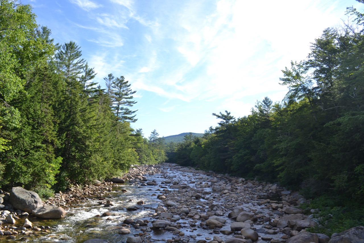
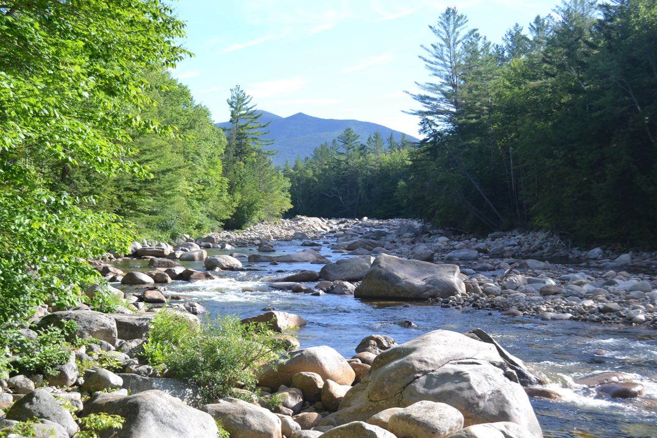
The long walk begins at the Lincoln Woods parking area. Walk to the end of the parking area and onto the deck of the visitor center. Turn left at the trail signs and walk down the stairs onto a gravel connecting path. Turn left, then right and cross the iconic suspension bridge over the East Branch of the Pemigewasset River, a much larger and wilder waterway than the "main" branch of the Pemigewasset River. On the other side, turn right and follow the very wide and flat Lincoln Woods Trail as it follows the East Branch on the bed of an old logging railroad, last operated in 1948. The first mile is mostly over graded surface, but soon after, the pathway becomes studded with railroad ties. At 0.7 miles, the trail goes along a fence atop a washed-out bank, which provides a nice spot to look out over the river. Just beyond, the trail passes over Osseo Brook as it drains into the East Branch and proceeds to parallel it. The trail continues next to Osseo Brook for 0.6 miles before the brook diverges to the left, followed by the Osseo Trail. At this junction is an informative sign about logging artifacts which may be found in the forest. Just after this, the trail passes a clearing from a logging camp on the left. In another 0.2 miles, the trail reaches its second viewpoint over the river, next to a long piece of rail. Bondcliff's south spur rises prominently above the river, with the summit of Bondcliff to its left. The trail then crosses Birch Island Brook on a bridge and continues very straight for 0.9 miles. After this section, turn left onto Black Pond Trail.
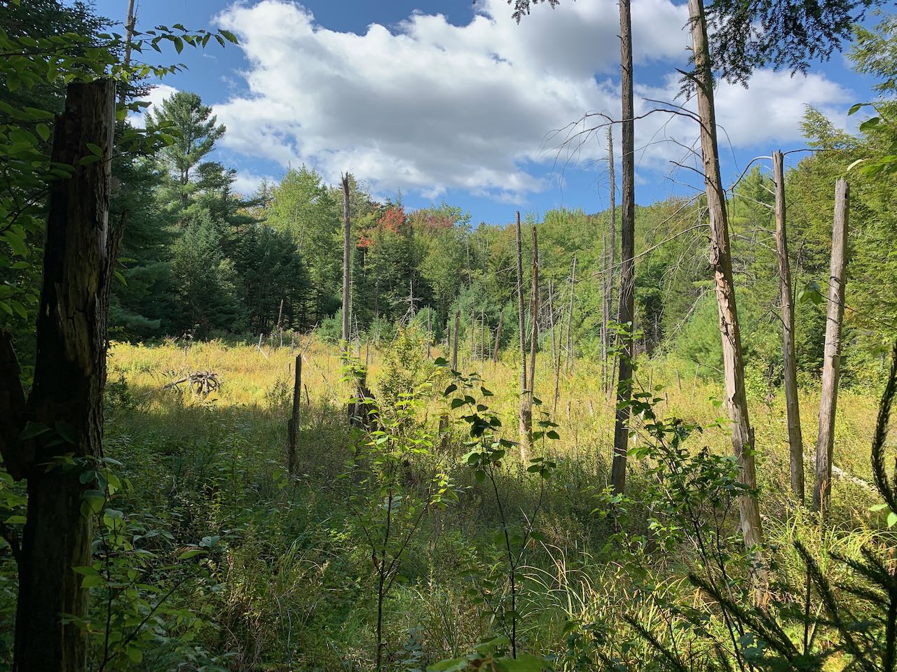
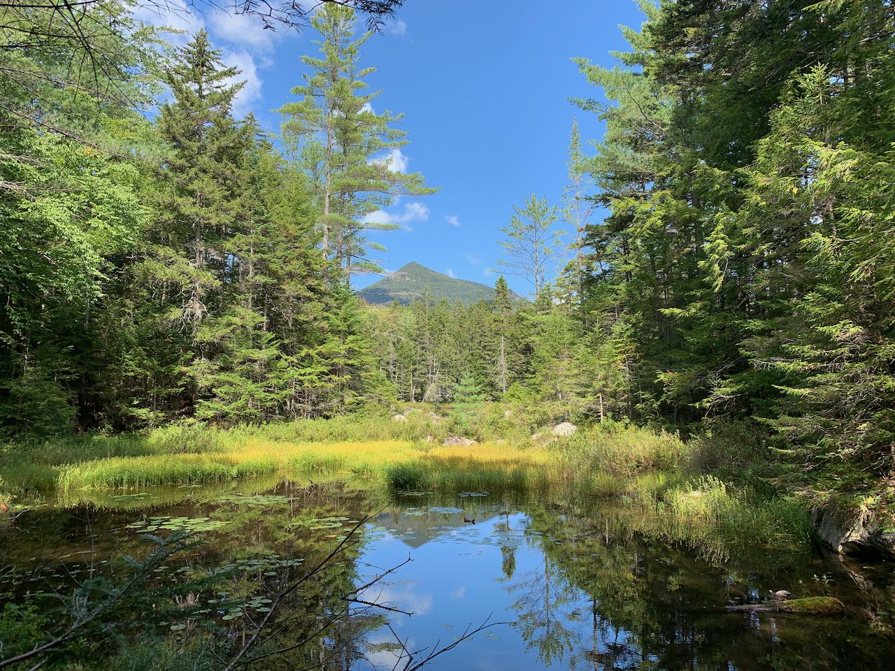
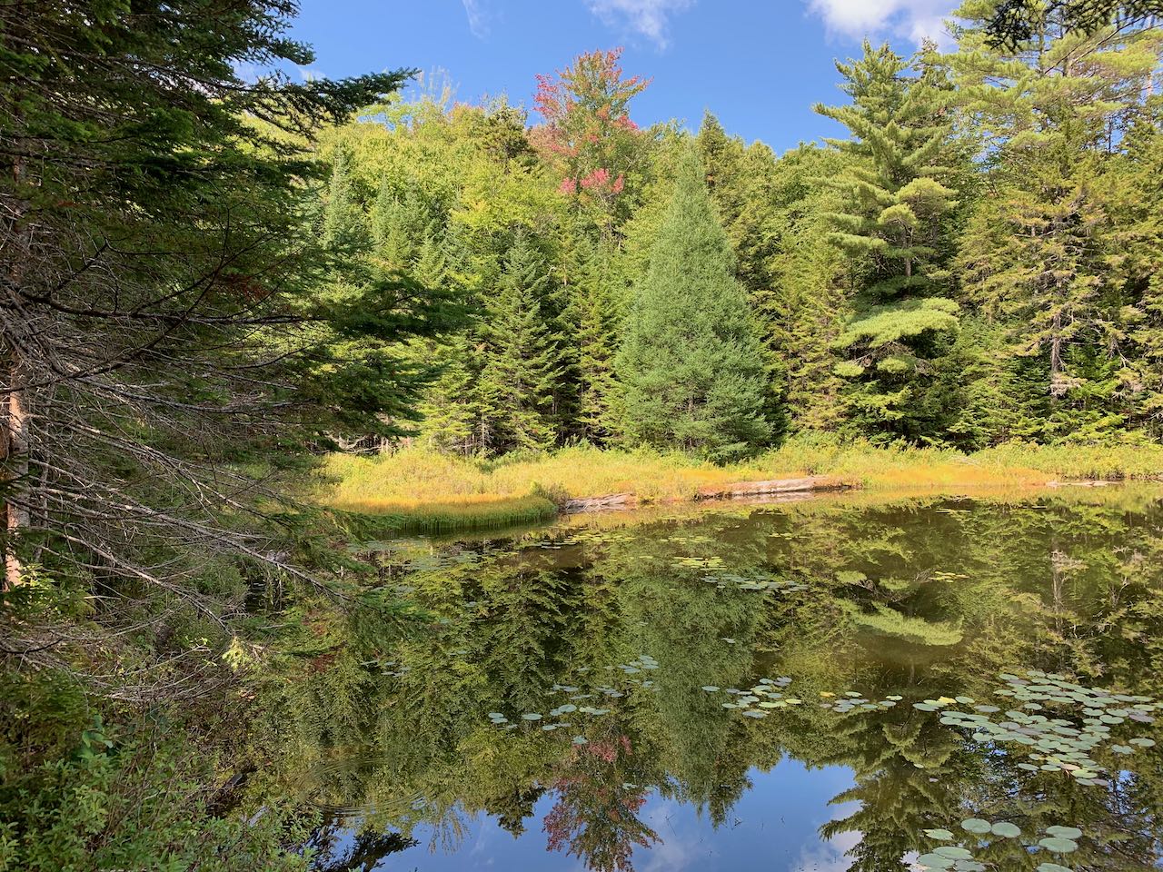
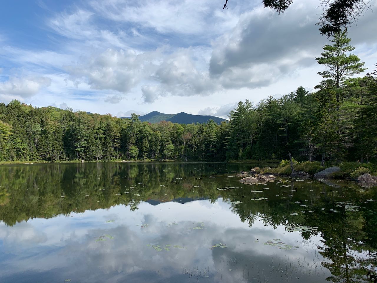
The path meanders around along the edge of the tiny Ice Pond, now only a snag-filled marsh, making many twists and turns. After 0.2 miles, the trail straightens out and heads up the valley around Birch Island Brook. Soon, the brook comes into view down a steep bank to the left. After another 0.3 miles, the trail passes a fork in the brook and crosses the smaller branch draining down from Black Pond. The trail follows this brook up to its source, crossing back over it less than 0.1 miles ahead, and then again 0.1 miles beyond that. After a final 0.1-mile stretch past the third crossing, the trail passes a stagnant pool at the outlet of the pond, hemmed in by reeds and lily pads, over which you can see the sharp peak on the south end of the Owl's Head Ridge. The path reaches the open water of Black Pond just a bit further and ends at a fine sitting rock on the shoreline, although an unofficial trail continues past this. The contemplative pond reflects the summit of Bondcliff, which rises majestically over the trees on clear days. A picturesque rocky point with a few tall trees extends into the water on the right side.
Printable directions page